
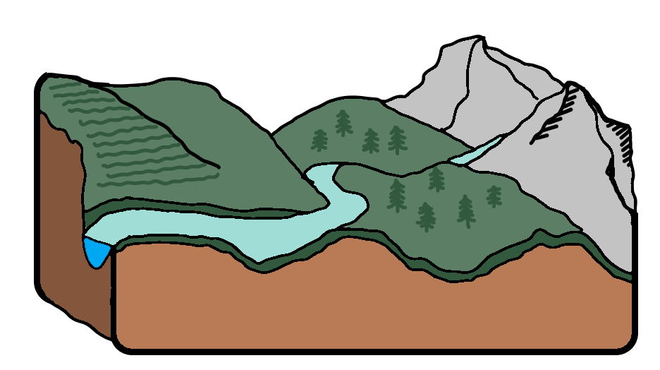
A river is a body of water that flows from the centre of gravity downhill, often flowing towards an ocean, sea, lake or another river. In some cases, a river flows into the ground and dries at the end.
The start of a river is called the ‘source’ and where it meets a larger body of water like the sea or lake, the ‘mouth’. An ‘estuary’ is the tidal mouth of a river where it meets the sea, often characterised by wide banks of deposited mud, sand and silt exposed at low tide. Rivers can have multiple sources and tributaries, which are small rivers or stream flowing into a larger river or lake.
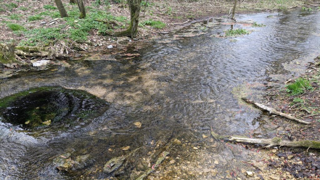
Source of the River Thames 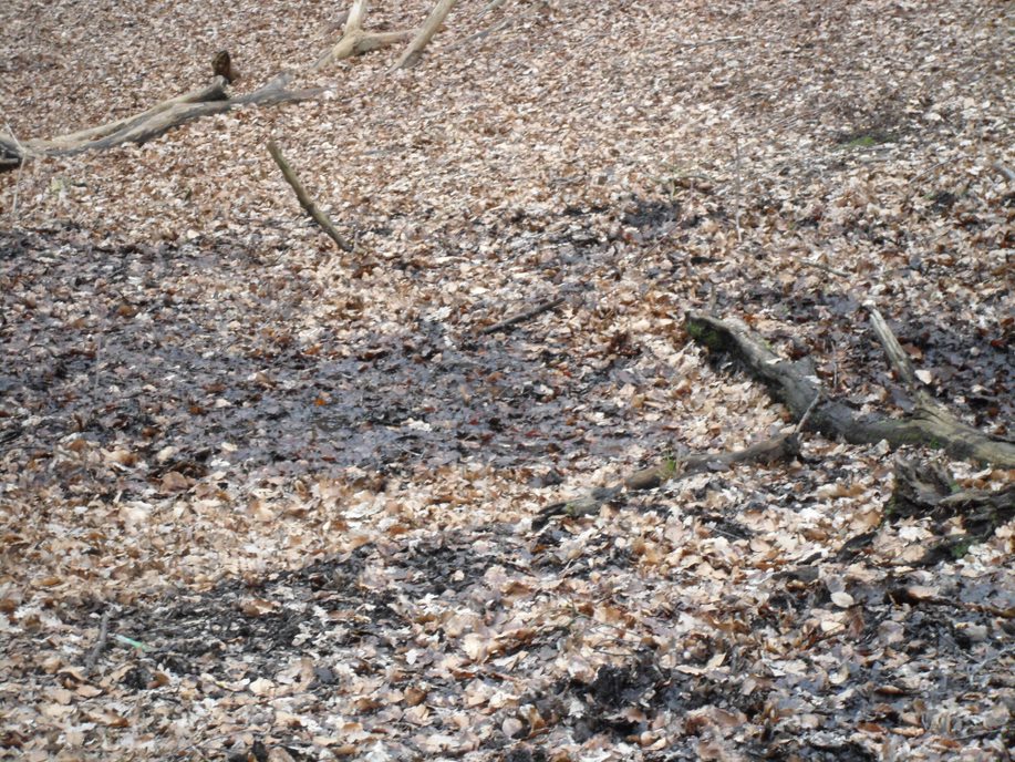
Source of the River Ching
Rivers are a medium of changing the landscape, through their action of going downstream. There are many fluvial (river) processes which include erosion and deposition:
Erosion
Erosion can occur vertically (downwards) or laterally (across) and there are four main types.
Hydraulic Action
This refers to the process of the force of water. Air becomes trapped in the cracks formed, and combined with expansion and contraction when it is hot or cold, it causes splits.
Abrasion
This refers to when there are rocks that grind together, like sand paper, causing a grating effect. This causes rocks to shrink.
Attrition
This relates to the process of rocks hitting each other and splitting. This would cause the rocks to break apart, become smaller and eventually erode overtime and become more rounded.
Solution (also known as Corrosion)
This is when chemicals in the water erode the rocks due to the chemical composition, such as limestone being a softer, erodible rock.
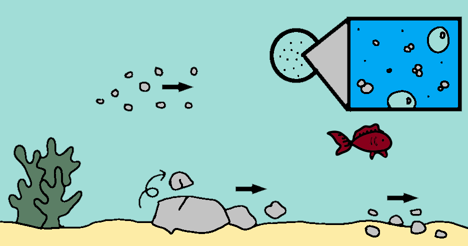
Transportation
Materials are also transported within rivers, and there are four main ways they were transported. These sediments can then be deposited further downstream or into the sea.
Solution
Minerals can be dissolved in the water and carried along in a solution. Different conditions would affect how these are deposited.
Suspension
Light sediment and material can be carried along in the water easily.
Saltation
This is when small pebbles and stones are bounced along the river bed, and can lead to further erosion.
Traction
This is when large boulders and rocks are rolled along the river bed.
What landforms are created by rivers?
Rivers can create very distinctive landforms which result from different physical processes. Lets examine the different characteristics and land formations resulting from erosion and deposition.
Erosion
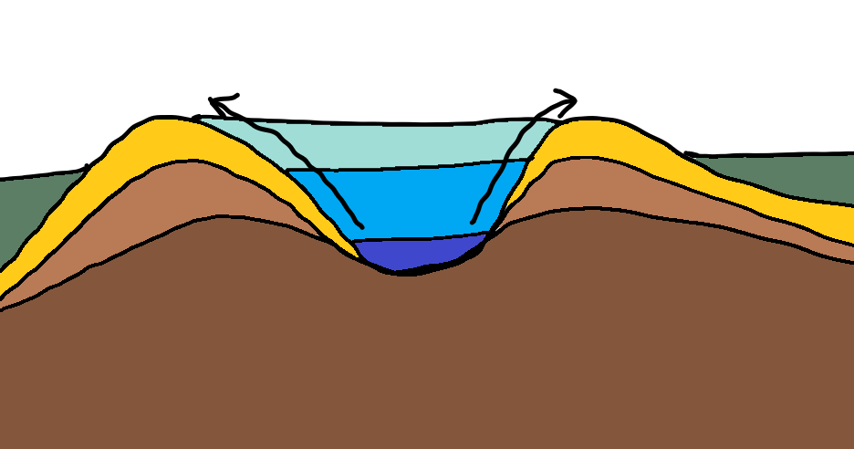
Interlocking Spur
An interlocking spur is land which looks locked together. It is formed as a combination of of slow and less powerful vertical erosion on the riverbed, and weathering to the sides. Hard rock takes longer to erode and weather away, and thus creates a V-shaped valley.
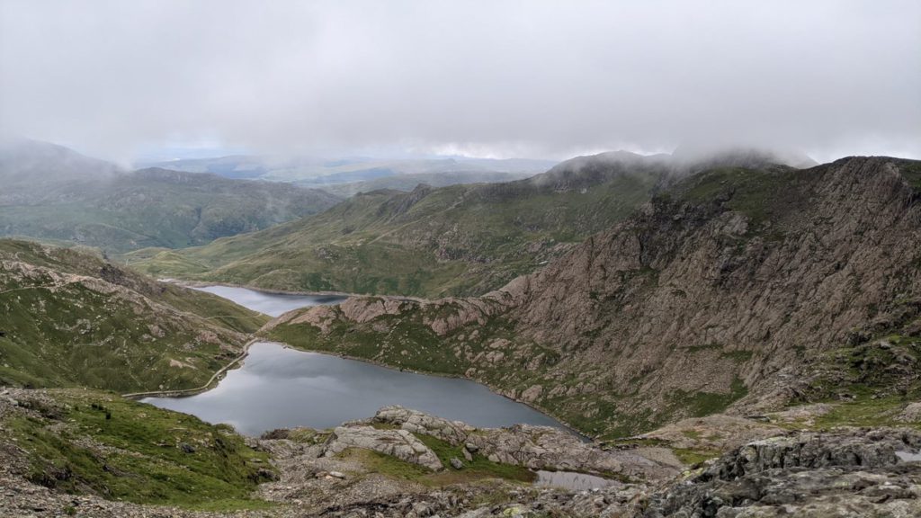
Snowdon Valley 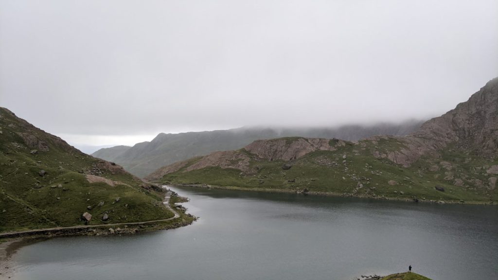
Snowdon Valley
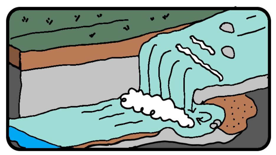
Waterfalls and Gorges
A waterfall is a sudden drop along the river course. It forms as soft rock is eroded quicker than hard rock creating a step. The hard rock is undercut, forming an overhang vulnerable to erosion such as abrasion and hydraulic action. The constant erosion creates a plunge pool where the fast paced water drops continuously, eroding the rock underneath and further eroding the softer rock. Overtime the overhang will collapse and the waterfall would continue to retreat upstream. A steep sided valley remains where a waterfall once existed, called a gorge
Erosion and Deposition
Meanders
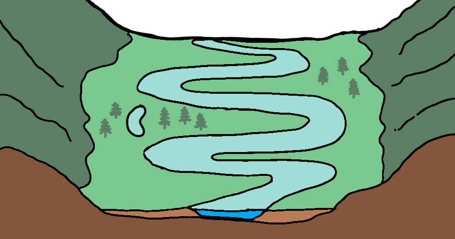
As you go further downstream, a river gains more momentum as it picks up force and sediment. This carried sediment creates further erosion on the river bank, widening the river. As rivers flow on a plateau, it develops bends called meanders. When there is a bend in the river, more of the force is directed on the outside of the bend, and sediment deposited as it loses power on the inside of the bend. The lateral erosion on the outside of the bend causes the bank to be undercut, causing a river cliff. The deposited sediment causes a slope, referred to as a river beach.
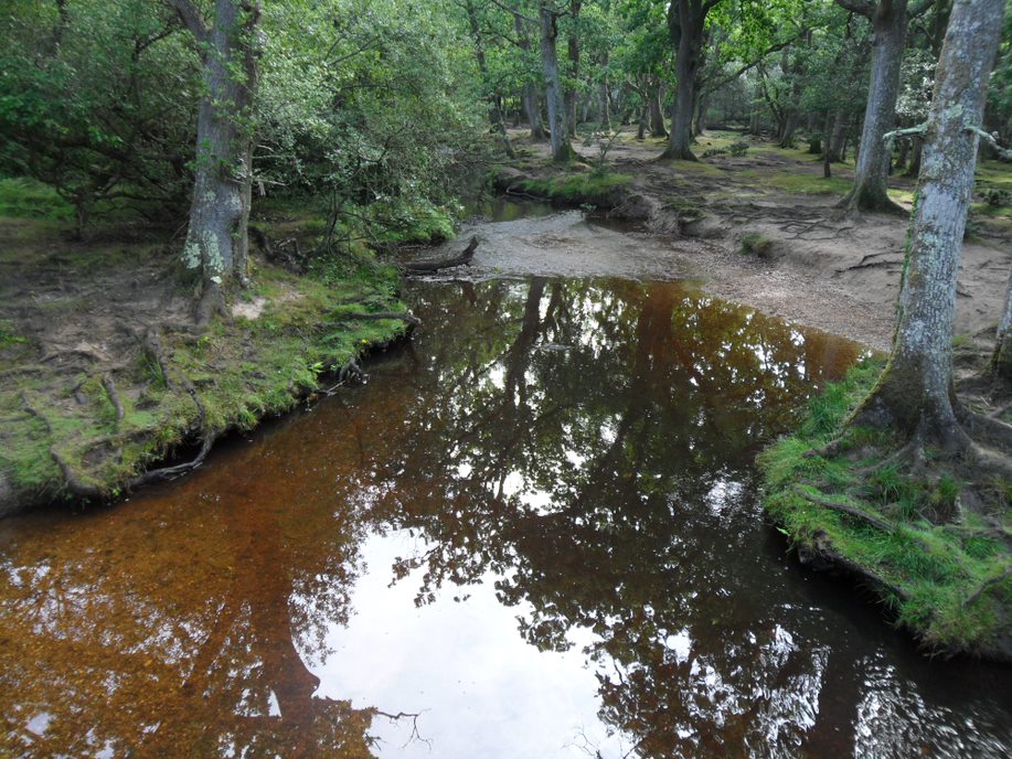
New Forest 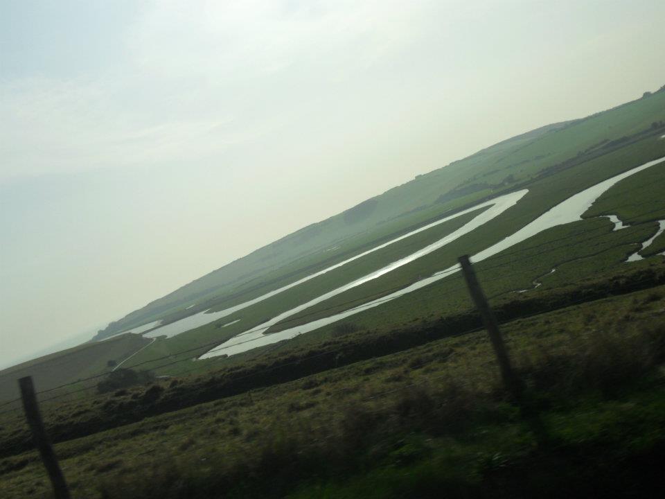
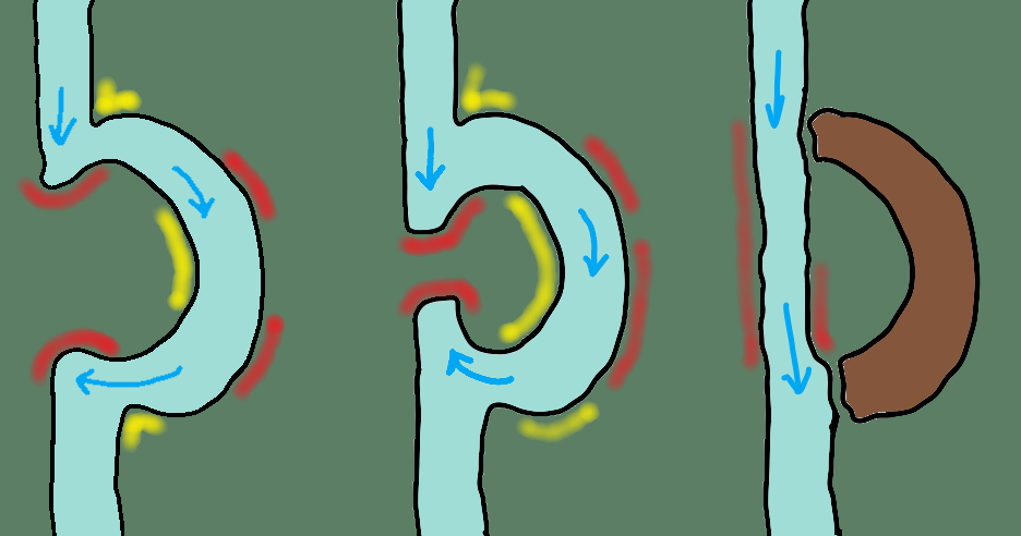
Ox Bow Lake
Ox-Bow lakes are historic meanders that have been cut-off from the main river overtime. Erosion changes the the shape of the river, and it does the same with meanders. The river will eventually take a new, straighter route. Deposition will cut off the original meander, leaving a horse-shoe shape.
Deposition
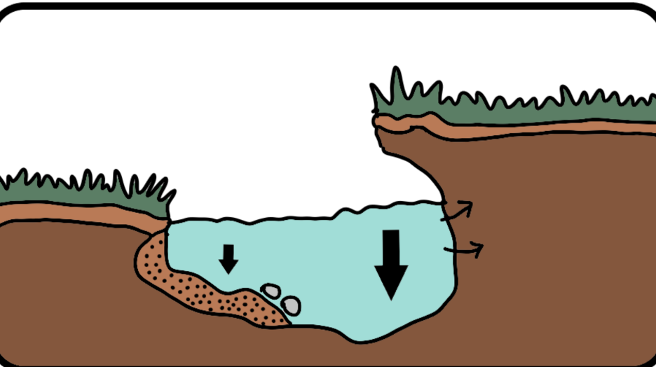
Levées
A levee, dike, dyke, embankment, floodbank, or stop bank is a natural or artificial wall structure that often runs parallel to the course of a river in its floodplain or along low-lying coastlines to prevent flooding. Levees may be used to increase available land for habitation or simply divert water to use the nutrient enriched soil. As flooding occurs, deposition leaves sediment on the floodplain and these deposits increase levee heights.
Floodplain
A floodplain is an area of land which is covered in water when the a river bursts its banks, or breaks through the levees. Overtime erosion of the banks causes the river to widen, and it’s floodplain to expand. During a flood, material will be strewn over the floodplain, increasing the banks and land overtime. The deposits from the river act as a good fertilizer, referred to as alluvium. The floodplain is usually flat land surrounded by towering hills and valleys.
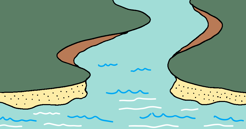
Estuary
An estuary is where the river meets the sea. The river here is tidal, and has ebbs and flows like the sea. When the sea retreats the volume of the water in the estuary is reduced, leaving silt deposits and creating mudflats.